
Geographical hints: - The 32-40 Km Gap at the 960 Km long western ghat is causing the weather and the life style of the district. Through the gap known as 'Palakkad churam' the north east monsoon reaches Kerala. Kerala with other parts of India are connected through the gap. No seashore in the district. High ranges only.Rivers: Bharatapuzha, Kannadi, Kalpathy, Chittoor puzha, Bhavani, Siruvani, Gayathri and Thuthapuzha.Forest: 136,257 Hectare
Palghat or 'Palakkad' is the land of palmyras and paddy fields. Along with Kuttanadu, Palakkad is one of the chief granaries of Kerala. It is often called the Gateway of Kerala. Many rivers that flow into the Bharathapuzha originate from these mountains. In the past, this land was known as Palakkattusseri. Etymologists trace the word Palakkadu from Paalainilam, meaning dry area. Palakkad had a long history dating back to the Paleolithic period. A large number of megalithic relics have been discovered from here.
Palakkad Fort, situated in the very heart of the town, is the most beautiful and the best preserved fort of Kerala. The sober silence of the granite walls reminds us of old tales of valour and courage. It was constructed in 1766 by Hyder Ali of Mysore. In 1790 the fort was taken over and remodified by the British. The fort is protected by the Archaeological Survey of India.
Palakkad Fort is an old fort situated in the heart of Palakkad town of Kerala state, southern India. It was recaptured and rebuilt grandly by Sultan Hyder Ali in 1766 ACE and remains one of the best preserved forts in Kerala.The Palakkad Fort is said to have existed from very ancient times, but believed to be constructed in present form in 1766 A.D,
 but little is known of its early history. The local ruler, Palakkad Achchan, was originally a tributary of the Zamorin, but had become independent before the beginning of the eighteenth century.In 1757 he sent a deputation to Hyder Ali seeking help against an invasion threatened by the Zamorin. Hyder Ali seized upon the opportunity to gain possession of a strategically important location such as Palghat and from that time until 1790 the fort was continually in the hands of the Mysore Sultans or the British. It was first taken by the latter in 1768 when Colonel Wood captured it during his raid on Hyder Ali's fortresses, but it was retaken by Haider a few months later. It was recaptured by Colonel Fullarton in 1783, after a siege that lasted eleven days but was abandoned the following year. It later fell into the hands of the Zamorin’s troops. In 1790 it was finally captured by the British under Colonel Stuart. It was renovated and was used as a base for operations that ended with the storming of Srirangapatnam. The fort continued to be garrisoned until the middle of 19th century. In the early 1900s it was converted into a taluk office.
The Parambikulam Wildlife Sanctuary, which is 130 kms away from Palakkad, extends over an area of 285 sq, Kms. It offers a scintillating sight of rare wild animals. There are quite a few hill tribes here like Malayars, Kadas and Muthuvaans.
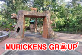
Boat cruises can be arranged in the Parambikulam Reservoir. The rest house of State Forest Department at Thoonakadavu. Thellikkal and Elathode offer comfortable lodging facilities. Tree house in the Reserve forest area in Thoonakkadavu has to be booked in advance.Parambikulam Tiger Reserve, which also includes the erstwhile Parambikulam Wildlife Sanctuary, is a 391 square kilometres (151.0 sq mi)protected area in Kollengode Block, Chittur taluk in Palakkad district of Kerala state, South India. The wildlife sanctuary, which had an area of 285 square kilometres (110 sq mi) was established in 1973. It is in the Sungam range of hills between the Anaimalai Hills and Nelliampathy Hills.Parambikulam Wildlife Sanctuary was declared as part of the Parambikulam Tiger Reserve on 19 February 2010.Including the buffer zone, the tiger reserve has a span of 643.66 km2. The Western Ghats, Anamalai Sub-Cluster, including all of Parambikulam Wildlife Sanctuary, is under consideration by the UNESCO World Heritage Committee for selection as a World Heritage Site.The sanctuary is the home of four different tribes of indigenous peoples including the Kadar, Malasar, Muduvar and Mala Malasar settled in six colonies. Parambikulam Tiger Reserve implements the Participatory Forest Management Scheme (PFMS). People from tribal colonies inside the reserve are engaged as guides for treks and safaris, and are provided employment through various eco-tourism initiatives.The tiger reserve hosts many capacity building training programmes conducted by Parambikulam Tiger Conservation Foundation in association with various organisations.
A temple of Siva and the ruins of a mud for near Thrithala Chalissery Road are notable cultural monuments. The Kattilmadam temple on the Pattambi-Guruvayoor road has archaeological significance. The small granite structure is a testimony of Buddhist importance, built probably during the 9th or 10th century A.D. A memorial for Pakkanar the Pariah saint, stands near Thrithala Kootanad road.Renowned writer and social worker V.T.Bhatathiripad was born here.

Thrithala is a village in Pattambi taluk in Palakkad District of Kerala state, South India. The village is located along the banks of Bharathapuzha and is famed for its Shiva temple and Trithala Juma Masjid.The Siva temple, probably built during the 9th and 10th century, marks the transition from the Chola to the Pandya style of architecture. According to a legend, the child Agnihotri was bathing in the river along with his mother. He heaped the sand in the form of a mound on a plate ('thalam' in Malayalam). When the mother tried to remove the sand, she found that it has solidified in the form of a 'Siva Lingam'. Thus the deity is known as 'Thalathilappan', meaning God in a plate. The idol is said to have the constitution of sand. It is believed that the sharp bend in the river in the area was formed due to the river changing its course on its own, to give space for the temple to be built.
The Killikurissimangalam of Lakkidi near Ottapalam is renowned as the birth place of Kunchan Nambiar, the 18th century satirist and trendsetter in Tullal and its poetry. Nambiar's house is a protected monument of the State Government.The Sri Rama Temple at Thiruvilwamala, though located in the neighbouring district, is just on the other side of the river
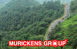
Lakkidi is one of the highest locations in Wayanad and is situated 700m above mean sea level, atop Thamarassery ghat pass. Vythiri is the nearest town, 5km from Lakkidi.Chain tree, Pookot Lake and a sightseeing point are within five km of Lakkidi. It is about 58 km northeast of Kozhikode district.Three km from Lakkidi is Pookot Lake, a natural freshwater lake spread across 15 acres. It is one of the rarest reservoirs of water in Wayanad. Surrounded by meadows and hills, it is a favourite picnic spot.Lakkidi's annual rainfall averages from 600cm to 650cm. Many species are found in this area including lion-tailed macque, rare birds, Indian Shag (Phalacrocorase fuscicollis), Little Cormorant (Phalacrocorax niger), Little Green Heron (Ardeola striatus), and Pond Heron (Ardeola grayii).Lakkidi has rich soil that supports farming of coffee, tea, oranges, spices, etc. It gets copious rainfall laterite soil. Jawahar Navodaya Vidyalaya in Wayanad district is situated here.
Kottayi is about 15 kms via Putur from Palakkad. The tiny village had become famous as the native place of the
 late Chembai Vaidyanatha Bhagavathar, the doyen of Karnatic music.
Kottayi-II is a village in the Palakkad district, state of Kerala, India. Kottayi-II and Kottayi-I come under the Kottayi gram panchayat.
The Nelliyampathy hills are extremely fascinating and offer an easy escape from the scorching summer of Palakkad. About 52 kms. South of Nenmara is this cool hill resort. The height of the hills ranges from 467 metres to 1572 metres.
 Nelliyampathy is a hill station within the Nelliyampathy Forest Reserve, in the southwest Indian state of Kerala. The road to it, which goes through the dense forests of the Western Ghats, is known for its many hairpin turns. To the west is Kesavan Para, a vantage point with views of nearby tea plantations. Farther west is the 19th-century Pothundi Dam. Northeast is the Seetharkundu Viewpoint, with waterfalls nearby.
You have to negotiate at least 10 hair-pin curves on the Ghat road passing though breath-taking evergreen forests of the Sahya Ranges. Pothundi Reservoir glints in the distance as a sapphire set amidst the green of the forests.
Nelliyampathy had immense trekking potential. At Kaikatty there is a community hall which could be used as a camping place for trekkers.
Seethakundu at Nelliyampathy offers a fantastic view of the valley below-a wide angled panoramic picture of about one third of Palakkad, as beautiful as the green Valleys of Kodaikkanal.
Malampuzha is a village in Palakkad district of Kerala, South India, near to the Malampuzha Dam.Malampuzha exudes the charm of harmony in nature, a perfect synchronization of the grandeur of the mountains blending with the music of the rivers. It is 10 kms. from Palakkad. The garden complex at Malampuzha draws the largest holiday and weekend crowds to Palakkad.Malampuzha Dam is located eight km from Palakkad town. It was built in 1955 and the garden was renovated recently.The main attractions are the suspension bridge, the cable car ride and the Fantasy Park. There are several gardens including one cute Japanese garden. The Yakshi statue of Kanayi Kunjiraman is also reputed even though the nudity of the structure is not approved by the conservative society of Kerala. The dam is accessible by bus and the last bus returns to town by 8.00 pm. The nearest railway station is Palakkad Junction which is otherwise known as Olavakkode
 The children's park with a toy train, a miniature zoo and an aquarium housed inside a fish shaped building, await the pleasure and delight of children.There is a swimming pool and facilities for boating in the canal and in the reservoir. A small garden in Japanese style, gives a touch of exotic charm to the landscape. So too does the hanging bridge across the canal. The only ropeway in south India is another attraction of Malampuzha garden. The ropeway is equipped with 64 chairs each with the capacity of two persons.Other items of interest in the park is the imposing concrete sculpture of Yakshi, the divine enchantress, by the renowned sculptor, Kanai Kunhiraman.Malampuzha Gardens, the only rock-cut gardens in South India made by Nek Chand, the renowned artist and winner of the prestigious Padmashree Award, is situated in Palakkad district. The entire garden is made from broken pieces of bangles, tiles, used plastic cans, tins and other waste materials. Also situated in the gardens is the massive Malampuzha Yakshi(female vampire) built in 1969 by Kanayi Kunhiraman, a greatly respected sculptor from the state. It is a spectacular relic of art that we are lucky to still have with us. The flowering beds, fountains and rose gardens along with an aerial ropeway make it a place that instantly soothes your soul.
Situated on the western border of Palakkad town and not far from the Railway station, is a historic Jain Temple. The place around the temple is known as Jainimedu. This is one of the few places in Kerala where the vestiges of Jainism have survived without substantial damages.Jainimedu Jain temple is a 15th-century Jain temple located at Jainimedu, 3 km from the centre of Palakkad, Palakkad district, Kerala, India.It is dedicated to Chandraprabha, a Tirthankar of the Jain faith. The celebrated Malayalam poet Kumaranasan, wrote his monumental poem Veenapoovu (The fallen flower) at a Jain house near here.The place name 'Jainimedu' itself is related to this temple.
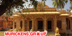
The granite walls are devoid of decoration. The 32 feet long 20 feet broad temple consists of four divisions with images of Jain Thirthankaras and Yakshinis in three of them. Kumaran Asan wrote his monumental poem 'Veena Poovu' (the fallen flower) at a Jain house here during his brief stay with his master Sri. Narayana Guru.The Jain temple was constructed in the 15th century by a family of diamond merchants from Karnataka.It was created by Inchana Satur.The temple was in a dilapidated condition for the past several years.At that time, there were around 400 Jain families in Jainimedu.The temple was renovated in 2013 and a Panch Kalyanak was performed.M. P. Veerendra Kumar, a prominent Keralite Jain, spoke at the event.The rituals were led by Bhuvanakeerthi Bhattakara Swamiji, the head of Kanakagiri Jain Mutt. This is one of the few places in Kerala where the vestiges of Jainism in Kerala have survived.
Attappady is about 38 Kms. North east of Mannarkkad. Above everything else, one will be awestruck by the grandiloquence of the divine architect who created this loveliness of forests, rivers and mountains.

It is also a place of great interest to anthropologists as many Irulas and Mudugas inhabit here. These Adivasis worship the mountain peak 'Malleswaran' as a gigantic Siv-Ling. This peak and the River Bhavani exert tremendous influence on the lives of the tribal. There is a P.W.D. rest house and a VIP guest house at Agali. Besides these government houses, there are also a few private hotels.
Attappadi is among the biggest tribal settlements in Kerala. This hill area is famous for its worship of the mountain peak 'Malleeswaran' in the form of a massive 'Siva-linga’ and Sivarathri celebrations at the Malleeswaram Temple is an extremely important event in the area. The Bhavani River plays an integral part of the celebrations as well. The area is under government protection to conserve the aesthetics of this unique place. The reserve area is currently inhabited by Irulas, Mudugas and Kurumbar. Their population has dwindled but it is still among the most picturesque locations in Palakkad district. A PWD Rest House, a VIP Guest House and a few private hotels offer accommodation at Agali, 23 km northeast of Mannarkkad.
'Sivarathri' is celebrated at the Malleswaran temple by the tribal.
Silent Valley is about 50 kms. North-west of Mannarkkad. Ecologists describes this area as the sole surviving bit of evergreen forest in the Sahya Ranges. This National Park covering about nine thousand hectares has been named Silent Valley due to its own peculiarity.
 These forests are devoid of the chirping of cicadas. Vehicular transport is usually allowed only upto Mukkali. From Mukkali you have to cover at least 24 Kms. on foot to reach the source of Kunthipuzha which flows through the valley before merging into the Bharathapuzha or the 'Nila'.
There is a huge wild tree of Kattuaiying variety. It is hollow within and can hide at least 12 people in it.Silent Valley National Park a national park in Kerala, India. It is located in the Nilgiri hills, has a core area of 89.52 km2 (34.56 sq mi), which is surrounded by a buffer zone of 148 km2 (57 sq mi). This national park has some rare species of flora and fauna. This area was explored in 1847 by the botanist Robert Wight. The national park is one of the last undisturbed tracts of South Western Ghats mountain rain forests and tropical moist evergreen forest in India. Contiguous with the proposed Karimpuzha National Park (225 km2 (87 sq mi)) to the north and Mukurthi National Park (78.46 km2) to the north-east, it is the core of the Nilgiri Biosphere Reserve (1,455.4 km2), and is part of the Nilgiri Sub-Cluster (6,000+ km2), Western Ghats World Heritage Site, recognised by UNESCO in 2007. Plans for a hydroelectric project that threatened the park's biodiversity stimulated an environmentalist social movement in the 1970s, known as the Save Silent Valley movement, which resulted in cancelling the project and creating the park in 1980. The visitors' centre for the park is at Sairandhri.
Thunchath Ezhuthachan, the author of Adhyatma Ramayana and the father figure of Malayalam poetry, spent his last days here. Situated in Tekkegrama near Anikkode on the Palakkad-Chittur Road is his memorial. A srichakra and few idols worshipped by him, the stylus, the wooden slippers and few old manuscripts are exhibited here.
The village is located on the banks of the river Sokanasini the destroyer of sorrows.
A natural spring in front of the old Sree Rama Temple has made Thenari famous. The name itself is derived from the spring. Several legends are woven around this spring. It is believed that the water is as sacred as Ganga.Thenari, located on Pollachi road from Palakkad town is a holy place. It is believed that the waters of the natural spring, located in front of the old Sree Rama Temple here, is as sacred as the waters of the Ganges. Thenari is also famous for a coir fibre unit.

Sree Rama Temple at Thenari is a famous temple dedicated to Lord Rama located in the Palakkad district of Kerala. Thenari is considered as a holy place because of the natural spring in front of this ancient temple. It is believed that the water in it is as sacred as the waters of the River Ganges. Many devotees visit this rare Rama temple every day to offer prayers. The Theertham tank in front of the sanctum sanctorum is considered as the Ganges. The temple has some sub-deities in addition to the main deity, Lord Rama such as Lord Ganesha and Lord Hanuman. Deepavali is celebrated in this temple with grandeur. Karkidaka Vavu, a ritual carried out in memoir of the departed souls of ancestors, is also having great significance in the Thenari Sree Rama temple. It is nearly 12 kilometers away from Palakkad railway station. Check the customized tour packages of Tour My India to Kerala for pilgrimage before you plan your trip to this state.
Well known as a grove abounding in peacocks, the name is perfectly justified. Myladumpara is 7 kms. From Kottayi. Its other but less popular name in Choolanoor.

Myladumpara is a small Village/hamlet in Nedumkandom Block in Idukki District of Kerala State, India. It comes under Udumbanchola Panchayath. It belongs to Central Kerala Division . It is located 34 KM towards East from District head quarters Painavu. 19 KM from Nedumkandam. 158 KM from State capital Thiruvananthapuram
Dhoni a reserve forest area is about 15 kms. From Palakkad. This forest has among other captivating sights a small but splendid waterfall. The site can be reached after a fairly long climb of three hours from the base of the Dhoni hills.Dhoni is situated around 15 Kilometers from Palakkad town in Kerala, India. Dhoni is named after a boat shaped rock on one of its hill, as boat in Malayalam is called "thoni". It is famous for Dhoni Waterfalls and the Western Ghat forests. Dhoni is bordered by Western Ghats on north. It is also a popular trekking spot for tourists. Dhoni farm is situated at Dhoni.

Dhoni Waterfalls is located around 15 km from Palakkad and around 34 km from Kollengode Town in Palakkad. An entry pass is required before entering the area. You have to walk 4 km from the bottom of the hill to reach the waterfalls. The roads are not tarred, and one can see water flowing down between the rocks on the way up. No restrictions for carrying food to the top. A three-hour trek from the base of the Dhoni hills will take you to the pristine beauty of nature and the lush green surroundings will rejuvenate your senses. The trekking starts at the foot of the hills near the Teak plantations. A narrow mountain way is there for four-wheel drives and bikes that lead up to the waterfall; however private vehicles are prohibited from traversing these roads. This 4 km long trekking trail through the lush green environs bestows one with a quiet isolated space to witness nature in its most tranquil form. This guided trek is best to start trekking early mornings, so more time can be spent in the company of the gorgeous waterfall. The waterfalls are full during monsoon and it overflows with beautiful small streams gushing down, so the best time to visit is during monsoon (June – October). Bathing in the waterfall is not allowed, though there are places down the stream for bathing. The return journey is comparatively easy lasting usually around 2 hours.
32 Kms south east of Palakkad, Meenkara is a fascinating picnic spot by virtue of its dam, garden, fishponds and natural beauty. The dam is constructed across river Gayathri, which flows into the river Bharathapuzha.
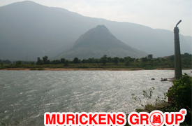
The Meenkara dam and reservoir are located 32 km. south-east of Palghat town and 24 km. west of Pollachi, a town in Tamil Nadu. The nearest railway station is Muthalamada on Palakkad-Pollachi section of Southern Railways, which is 10km. from Meenkara headworks. The nearest airport is Coimbatore, which is 80 Km. from Meenkara headworks. The project consists of a)An earthen dam across Meenkara river, a tributary of Bharathapuzha b)A net work of canals consisting of two main canals, to irrigate an area of 3035 ha. The dam consists mainly of an earthen dam 934m. long with a masonry spillway 30m. long. Maximum height of the dam is 18.9m. Gross storage of the reservoir is 11.33 Mm3. The spillway has two vertical lift type shutters, and has a capacity of 472.6 cumecs. The sluice for taking out water for irrigation, is located in the earth dam.
A Meenvallam waterfall is around 8kms from Thuppanad junction on the Palakkad- Manarkkad route. It is a combination of enchanting beauty and scenic splendor. The water falls from nearly 20 to 25 feet and the depth is around 15-20 feet. There are 10 steps of waterfalls of which eight are located in the upper hills inside the dense forest. They are inaccessible, only the remaining two steps are accessible. One has to hire a jeep from Koomankund junction and then trek a distance of 1.5 km by crossing the river Thuppanad.

Meenvallam Waterfalls, a hidden gem in Palakkad district, cascades from as high as 45 metres into Thuppanadu River which originates from the Kalladikodan Hills. Thuppanadu River later joins with the Thoothapuzha, which in turn empties into Bharathapuzha River. Located 8 km deep inside the forests from Thuppanad Junction on the Palakkad-Manarkkad Route in NH 213, the waterfalls are catching the attention of a lot of our visitors. A small hydel project, with an installed capacity of three mega watts has been constructed by the Palakkad District Panchayat at Meenvallam. The waterfalls and the surrounding area is protected and maintained by Thudikkode Vana Samrakshana Samathi of Olavakkode Range in Palakkad Forest Division. The forests surrounding the waterfalls are an extension of the Silent Valley National Park. The waterfall is 34 km from Palakkad and 26 km from Mannarkkad.
Payyannur was the main venue of the Salt Sathyagraha in Malabar.On 13th April , a batch of Congress volunteers under the leadership of K.elappan started on foot from Kozhikode to the beaches of Payyannurand broke the salt laws there on April 21.

The Salt March, also known as the Salt Satyagraha, Dandi March and the Dandi Satyagraha, was an act of nonviolent civil disobedience in colonial India led by Mohandas Karamchand Gandhi. The 24-day march lasted from 12 March 1930 to 6 April 1930 as a direct action campaign of tax resistance and nonviolent protest against the British salt monopoly. Another reason for this march was that the Civil Disobedience Movement needed a strong inauguration that would inspire more people to follow Gandhi's example. Mahatma Gandhi started this march with 79 of his trusted volunteers.[1] Walking ten miles a day for 24 days, the march spanned over 240 miles (384 km), from Sabarmati Ashram to Dandi, which was called Navsari at that time (now in the state of Gujarat). Growing numbers of Indians joined them along the way. When Gandhi broke the salt laws at 6:30 am on 6 April 1930, it sparked large scale acts of civil disobedience against the British Raj salt laws by millions of Indians.
The K.P.C.C. gave a call to the people of Malabar to observe 15th September , 1940 asAnti-Imperialist Day. The action was disapproved by the Congress High Command, but therewere meetings and demonstrations all over Malabar on this day. Kannur District was the centre of this agitation.
While the British were busy with the political settlement of the district, a serious revolt was headed by Kerala Varma Pazhassi Raja of the Padinjare Kovilakom of the Kottayam family.
MURICKENS GROUP
HO : KOTTAYAM-KADUTHURUTHY
BR : KOTTAYAM- CEMENT JUNCTION
ERNAKULAM-PALARIVATTAM
Real estate cunsulting officials at U.S.A. (Texas & Newyork) & Bombay
Email : mg@murickens.com, murickans@gmail.com