
Geographical hints: - Idukki district was formed in 28 January 1972. Crowded with Sahya mountains. The largest area for forest land in the State is at Idukki district. Total forest land : 2,60,907 hectare Nestled up in the mountains, Idukki extends an invitation to identify oneself with Nature. Here, where the mist plays hide and seek with the green mountains, the melody is set to the whistle of the crickets and the chirp of wild birds. Dark and deep forests with springs trickling down rocky crevices, falling steep into unfathomed chasms and rivulets flowing past rare flora and fauna, is indeed an idyllic setting to set oneself free of all fetters, understand, feel and perhaps realise, the beauty, power and glory of life. Other than places like Valara, Thommankuthu, Palkulamedu and Munnar which are of indescribable natural beauty, there are five wild life sanctuaries in Idukki district which need special mention.
Chinnar is a wild life sanctuary with an area of 90 sq.Km. The terrain here is undulating and rocky through out at an elevation ranging from 500 to 2400 metres above sea level. The thorny scrub jungle is the unique phenomenon of this sanctuary. The flora in this region consists of thorny scrub jungle, dry deciduous forests, sholas and grass lands.
A wide range of wild life is housed in its sanctuary. Elephant, gaur, sambar, spotted deer, barking deer, lion tailed macaque, Nilgiri Tahr, tiger, panther, wild dog etc. inhabit in this sanctuary. The aviary includes jungle fowl, spotted dove, pea fowl, jungle crow, Kerala laughing thrush, red vented bulbul, Indian hornbill, small green bee eater, blue throated barbet and a host of other small birds.
 This sanctuary is situated on either side of the Marayoor - Udumalpet road and is hence accessible by road.Chinnar Wildlife Sanctuary in Idukki is home to the Great Grizzled Squirrel of India. Numbering less than 200, they are among the most endangered species on the planet. Its unique location in the Western Ghats has ensured it gets less than 2 months of rainfall annually. The wildlife along with the deciduous trees makes it an ideal spot for trekking aficionados.
The beautiful Sandalwood forest nearby is highly recommended for a visit. One can view herds of gaur and elephants strolling around casually in this area. Dry deciduous forests, high ranges and some grassland add to the diversity of the sanctuary. While making the journey from Karimuthi to Chinnar, Spotted Deer, Sambar, Hanuman Langur and peacocks can be spotted alongside the road.
This sanctuary is situated on either side of the Marayoor - Udumalpet road and is hence accessible by road.Chinnar Wildlife Sanctuary in Idukki is home to the Great Grizzled Squirrel of India. Numbering less than 200, they are among the most endangered species on the planet. Its unique location in the Western Ghats has ensured it gets less than 2 months of rainfall annually. The wildlife along with the deciduous trees makes it an ideal spot for trekking aficionados.
The beautiful Sandalwood forest nearby is highly recommended for a visit. One can view herds of gaur and elephants strolling around casually in this area. Dry deciduous forests, high ranges and some grassland add to the diversity of the sanctuary. While making the journey from Karimuthi to Chinnar, Spotted Deer, Sambar, Hanuman Langur and peacocks can be spotted alongside the road.
Eravikulam is another wild life sanctuary proclaimed as a National Park since it supports the largest population of Nilgiri Tahr existing in the world now. Anamudi peak (2695 Metres), the highest point south of the Himalayas falls in the southern part of this park. The park is 135 k.m. from Kochi and is accessible by road. Most of the park is either grassland or part of the shola ecosystem and the average altitude is 2000 metres above m.s.l. The temperature varies from (-)3 degrees Celsius in winter to 29 degrees Celsius in summer.
 Severe frost occurs between the months of December and January and the average rain fall is 4800 m.m. During the monsoon, lashing rains, high velocity winds and poor visibility makes the area practically inaccessible. A wide variety of plant life is present here. The famous Strobilanthus Kunthianus, popularly known as Neelakurinji is one of the rare and threatened species that grows here. The Nilgiri Tahr is seen in the highlands and rocky regions of this national park. Sambar, barking deer, gaur, giant Malabar squirrel, tiger, panther, wild dogs, civet cat, jungle cat, Nilgiri langur, giant squirrel, grass owl, black winged kite, wood pigeon, black bird, Eurasian kestrel, jungle crow etc. are seen here.Eravikulam National Park situated along the summit of the Western Ghats in the high ranges of Idduki district of Kerala. This is also the land of "Neelakurinji", a flower that blooms once in twelve years. The Park is breathtakingly beautiful and is easily comparable to the best of mountain ranges in the Alps. With the highest peak south of the Himalayas – the Anamudi, located here, nature enthusiasts have ample opportunities for trekking expeditions and wildlife spotting.
Thattekkad bird sanctuary in Devicolam Taluk of Idukki lies on the northern bank of the Periyar river. The area of the sanctuary is 25 sq.Km. The presence of more than 200 varieties of birds in this area attracted the renowned ornithologist Dr. Salim Ali and his efforts are also behind the formation of this sanctuary. This sanctuary is 80 Kms. from Cochin and 60 to 450 metres above sea level.
 Important birds found here include large falcon, gray jungle fowl, white breasted water hen, hornbill, jungle bush-quail, etc. A study conducted by Bombay Natural History Society during 1985 identifies 253 species here. The vegetation in this area consists of tropical evergreen, semi evergreen, moist deciduous forests and plantations of teak, rosewood, mahogany etc. Further, more than 28 varieties of animals and nine varieties of reptiles have accepted this area as their natural habitat.Constituted during 1983, Dr. Salim Ali, the world famous ornithologist, is directly responsible for the wonders on display at the Thattekkad Bird Sanctuary. His famous survey of Travancore in the 1930s led to the formation of this modern day paradise for avian life. He noted that the area was rich in bird diversity and ought to be turned into a sanctuary to conserve the same. The over 300 species that reside in these tropical and deciduous forests are testament to his great vision.
One can run across the Sri Lankan Frogmouth, Racket Tailed Drongo, Bronzed Drongo, White-bellied Treepie, Shama, Yellow-browed Bulbul, Rufous Babbler, Malabar Parakeet, White-bellied Blue Flycatcher and the Malabar Grey Hornbill in these parts. Beautiful teak, rosewood and mahogany plantations can also be viewed here. It also boasts of over 28 mammal species and over 9 species of reptiles.
Important birds found here include large falcon, gray jungle fowl, white breasted water hen, hornbill, jungle bush-quail, etc. A study conducted by Bombay Natural History Society during 1985 identifies 253 species here. The vegetation in this area consists of tropical evergreen, semi evergreen, moist deciduous forests and plantations of teak, rosewood, mahogany etc. Further, more than 28 varieties of animals and nine varieties of reptiles have accepted this area as their natural habitat.Constituted during 1983, Dr. Salim Ali, the world famous ornithologist, is directly responsible for the wonders on display at the Thattekkad Bird Sanctuary. His famous survey of Travancore in the 1930s led to the formation of this modern day paradise for avian life. He noted that the area was rich in bird diversity and ought to be turned into a sanctuary to conserve the same. The over 300 species that reside in these tropical and deciduous forests are testament to his great vision.
One can run across the Sri Lankan Frogmouth, Racket Tailed Drongo, Bronzed Drongo, White-bellied Treepie, Shama, Yellow-browed Bulbul, Rufous Babbler, Malabar Parakeet, White-bellied Blue Flycatcher and the Malabar Grey Hornbill in these parts. Beautiful teak, rosewood and mahogany plantations can also be viewed here. It also boasts of over 28 mammal species and over 9 species of reptiles.
With its matchless scenic beauty and the facilities offered by the Periyar lake, Thekkady attracts a large number of tourists. The sanctuary spreads over an area of 673 sq.km and is situated at a height of 900 to 1800 metres above mean sea level.
 Facilities are available for cruising in this lake. Wild animals seen here include elephants, bisons, sambar, monkeys and wild bear. Fortunate visitors can have a glimpse of the tigers foraging in this area. However on sunny summer days one can see herds of wild elephants bathing in the lake. Bisons are a wary and hardy lot and usually never allow any intruder to approach them and the sound of the motor boats scare them away. But a keen animal lover can stay in one of the few observation towers for a couple of days and luck will surely come his way. Some of the famous tea gardens are located around this place. Further Peermede, 43 k.m. below Thekkady, has a golf course and offers excellent facilities for stay.The very sound of the word Thekkady conjures up images of elephants, unending chains of hills and spice scented plantations. The Periyar forests of Thekkady is one of the finest wildlife reserves in India. Spreads across the entire district are the picturesque plantations and hill towns that nestle beautiful trails for treks and mountain walks.It is one of the oldest tiger reserves in the country and the forests of Periyar is embellished by the presence of endangered species including White Tigers.
To explore the wilderness of Periyar Tiger Reserve tourists has many options like from boating to trekking.
Facilities are available for cruising in this lake. Wild animals seen here include elephants, bisons, sambar, monkeys and wild bear. Fortunate visitors can have a glimpse of the tigers foraging in this area. However on sunny summer days one can see herds of wild elephants bathing in the lake. Bisons are a wary and hardy lot and usually never allow any intruder to approach them and the sound of the motor boats scare them away. But a keen animal lover can stay in one of the few observation towers for a couple of days and luck will surely come his way. Some of the famous tea gardens are located around this place. Further Peermede, 43 k.m. below Thekkady, has a golf course and offers excellent facilities for stay.The very sound of the word Thekkady conjures up images of elephants, unending chains of hills and spice scented plantations. The Periyar forests of Thekkady is one of the finest wildlife reserves in India. Spreads across the entire district are the picturesque plantations and hill towns that nestle beautiful trails for treks and mountain walks.It is one of the oldest tiger reserves in the country and the forests of Periyar is embellished by the presence of endangered species including White Tigers.
To explore the wilderness of Periyar Tiger Reserve tourists has many options like from boating to trekking.
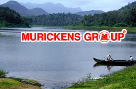
Idukki wild sanctuary is quite near the District Head Quarters at Kuyilimala near Painavu. The great reservoir formed by the construction of the Idukki Arch Dam and dams at Cheruthoni and Kulamavu offers beautiful sight to the casual visitor.
 Further the pristine forests and green hills around the area provide ample scope for trekking. In windy and rainy days elephants can be seen even on the road from Thodupuzha to the District Head Quarters. Unless offended these pachyderms wait on the road for a few minutes and give way to the vehicles. The Arch dam at Idukki, the highest of its kind in Asia, attracts a lot of tourists. Further the area is easily accessible by road, by being just about 100 k.m. from Ernakulam.Idukki district is among the most naturally endowed districts in Kerala and the Idukki Wildlife Sanctuary is a prime example. Located about 450-750 m above sea level, the sanctuary is cradled by the Cheruthoni and Periyar Rivers. The beautiful lake surrounding the sanctuary is perfect for romantic boat rides. The tropical evergreen and deciduous trees add to the charm of the place.
One can see elephants, bison, sambar deer, wild dogs, jungle cats, tiger and wild boar along with various species of snake including cobras, vipers, kraits and many non-poisonous snakes. There are many bird species as well, like the Grey Jungle Fowl, Malabar Grey Hornbill, woodpeckers and bulbuls. The sanctuary lies adjacent to the world famous Idukki Arch Dam.
Further the pristine forests and green hills around the area provide ample scope for trekking. In windy and rainy days elephants can be seen even on the road from Thodupuzha to the District Head Quarters. Unless offended these pachyderms wait on the road for a few minutes and give way to the vehicles. The Arch dam at Idukki, the highest of its kind in Asia, attracts a lot of tourists. Further the area is easily accessible by road, by being just about 100 k.m. from Ernakulam.Idukki district is among the most naturally endowed districts in Kerala and the Idukki Wildlife Sanctuary is a prime example. Located about 450-750 m above sea level, the sanctuary is cradled by the Cheruthoni and Periyar Rivers. The beautiful lake surrounding the sanctuary is perfect for romantic boat rides. The tropical evergreen and deciduous trees add to the charm of the place.
One can see elephants, bison, sambar deer, wild dogs, jungle cats, tiger and wild boar along with various species of snake including cobras, vipers, kraits and many non-poisonous snakes. There are many bird species as well, like the Grey Jungle Fowl, Malabar Grey Hornbill, woodpeckers and bulbuls. The sanctuary lies adjacent to the world famous Idukki Arch Dam.
Thommankuthu is another centre of attraction in Idukki, and is just half an hour's drive from Thodupuzha, the nearest town where accommodation is available. It is a famous place for water fall but is very dangerous to the school and college boys because of attractive slippery rokes and hidden ditch. It is due to heavy flow and frequecny of water we cannot get control in flowing water.
 It is saying that this water have medicinal value because number of valuable shrubs and herbs in this forest anciters says that this is one of forest which omit medicines in the form of water.
Thommankuthu has two equally enchanting waterfalls Thommankuthu and Ezhunilakuthu. This less explored destination in the middle of a pristine forest is famous for the waterfalls and the meandering rivers gracefully winding across the wood are a sight to behold. On the way to visit the falls, you can also see a tree house. The boom of the waterfalls hits you from miles afar especially during the monsoon season when all streams and rivulets inside the woods gush on with their full might to leap over a series of rocks to finally reach where you stand amazed at Thommankuthu.Thommankuthu Waterfalls is a beautiful spot for anyone visiting Idukki. This seven-step waterfall is among the premier adventure sport locations in the district. The place is famous for its plethora of picnic spots. Trekking aficionados can avail of a local guide to lead them through the woods here. There are also boating and fishing options available in the area and this gives one a great view of the valley.
The underground powerhouse of the Idukki Hydroelectric Project is located here. It is at the foot of the Nadukani hills
Moolamattom is the headquarters of Arakulam Panchayath in Thodupuzha Taluk, Idukki district in Kerala, India. It lies 22 km from Thodupuzha, on the banks of the Thodupuzha River. A lot of south Indian language movies are filmed here.It is also the site of the Moolamattom Power Station, the biggest underground Hydro-electric power station in India.
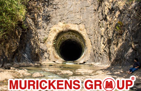
Moolamattom Power Station is the biggest underground Hydro-electric Project in India. The water from the Idukki Dam is carried by the underground pipes to the power station. The installed capacity of the Power House is 780 MW consisting of 6 generator units of 130 MW each. The regulated waters of Periyar falls through a drop of about 669.2 metres (2195 feet) while generating power in the underground power house. The tail waters makes Thodupuzha river at Thriveni sangamam which is 1 km. from Moolamattom Power Station. Teak plantation, Elappally waterfalls, Thriveni Sangamam, Hanging bridge are the main attractions of Moolamattom.Thumpichi St. Thomas mount, Nadukani, Malankara Dam, Kudayathoor Mala, Vayanakavu Temple and Ilaveezhapoonchira are the nearby attractions. Idukki Dam, the world's second and Asia's first arch dam, is 43 kilometers away from Moolamattom. There are several Malayalam and other language films shot at Moolamattom and near by places. Purappadu Rasathanthram, Drishyam, Papanasam are some of them.
Munnar was the summer resort of the British Government in the south. The town is situated on the confluence of three mountain streams, Muthirappuzha ( Kannimalayar), Nallathanni and Kundala. Munnar has some of the biggest tea plantations in the world.
 This hill station more than 5000 feet above sea level with its mist and flowers, has very good potential to be developed into a tourist spot
Munnar is a town and hill station located in the Idukki district of the southwestern Indian state of Kerala. Munnar is situated at around 1,600 metres (5,200 ft) above mean sea level,in the Western Ghats mountain range. Munnar is also called the "Kashmir of South India" and is a popular honeymoon destination.Sprawling tea plantations surround the serene hills of Munnar, which attract adventure travellers hungry for paragliding, treks to Anaimudi (South India's highest peak) and hikes originating at the confluence of three mountain streams. The stone Christ Church, built by the British in 1910, is adorned with renowned works of stained glass, and Eravikulam National Park, about 10 miles away, is home to equally colourful wildlife, including the endangered Nilgiri Tahr (ibex), ruddy mongoose and 120 bird species.
This idyllic hill station with its velvet lawns, exotic flora and fauna and the cool mountain air offers a rare experience to visitors, The Sita Devi Lake with its mineral water springs and picturesque surroundings is a good picnic spot. The lake is also ideal for trout fishing.

Devikulam is a wonderful picnic spot located 8 kilometres away from Munnar. Its velvet lawns and vast range of exotic flora and fauna have made it a must visit spot for all who are in the vicinity. The nearby Sita Devi Lake is frequented by visitors throughout the year. Its pristine waters and picturesque surroundings make it a beautiful location to unwind. This area is also perfect for trout fishing.The luxuriant greenery, refreshing open spaces, fragrant tea plantations, magnificent views from the high cliffs, and an extensive number of adventurous activities has made this destination rank amongst the list of most intriguing locations. A heaven on earth for those who are seeking ways and excuses to get closer to mother nature, Devikulam is known for the floors covered with gum trees in red and blue along with other natural marvels that take away the breath of the travelers. Scan through this list of places that one can visit when traveling to the gorgeous destination of Devikulam.The luxuriant greenery, refreshing open spaces, fragrant tea plantations, magnificent views from the high cliffs, and an extensive number of adventurous activities has made this destination rank amongst the list of most intriguing locations. A heaven on earth for those who are seeking ways and excuses to get closer to mother nature, Devikulam is known for the floors covered with gum trees in red and blue along with other natural marvels that take away the breath of the travelers. Scan through this list of places that one can visit when traveling to the gorgeous destination of Devikulam.
Situated at a height of 1700 m, Mattupetti is famous for its highly specialized dairy farm the Indo Swiss Livestock Project. Over a 100 varieties of high yielding cattle care reared here. Visitors are allowed into three of the 11 cattle sheds at the farm.
 Visit time: 0900 – 1100 hrs and 1400 – 1530 hrs.The Mattupetty lake and dam, just a short distance from the farm, is a very beautiful picnic spot. The sprawling Kundala tea plantations and the Kundala Lake are other attractions in the vicinity.
Nestled inside the hills of Munnar and very near to the Anamudi peak lies Mattupetty, the hill station at a height of 1,700 m. Mattupetty is located 13 km away from Munnar. Here you can enjoy the greenish valleys and feel the fabulous climate around. The main attraction of Mattupetty is the dam and the lake here. The dam of Mattupetty is a storage concrete gravity dam. The dam was constructed under the Pallivasal Hydro-electric project in the late 1940s, for the purpose of water conservation and power generation. Now the dam is a vital source of electricity generation in Munnar and also a haven for many wild animals and birds due to its constant water availability.Mattupetty - Munnar mattupetty dam in munnar Nestled inside the hills of Munnar and very near to the Anamudi peak lies Mattupetty, the hill station at a height of 1,700 m. Mattupetty is located 13 km away from Munnar. Here you can enjoy the greenish valleys and feel the fabulous climate around. The main attraction of Mattupetty is the dam and the lake here. The dam of Mattupetty is a storage concrete gravity dam. The dam was constructed under the Pallivasal Hydro-electric project in the late 1940s, for the purpose of water conservation and power generation. Now the dam is a vital source of electricity generation in Munnar and also a haven for many wild animals and birds due to its constant water availability. mattupetty dam in munnar The most attractive part of Mattupetty dam is its still water which reflects the tea garden around. You can engage yourself with water sport activities like speed boating organized by district Tourism Promotion Council of Idukki (Munnar) and enjoy the pretty natural surroundings of this beautiful dam. Adventure lovers also have options here like trekking in the Shola forest. In the midst of the hills, surrounded by the tea gardens, Shola forest and hilly woods lays a beautiful lake, just a few miles away from the Mattupetty dam. The serene ambience of the lake will take you to a world of peace. You have endless options – either you can go for boating in the lake or you can sit on the shore enjoying the tranquility here. Tourists can go for a speed boat, pedal boat, motor boat or row boat.
The natural habitat of the Nilgiri Tahr, Rajamala is 2695 m above sea level. Half the world population of the rare mountain goat which is fast becoming extinct, is now found here. The Nilgiri Tahrs are today reduced to small herds which are found in the

People flock to Rajamala to watch the NilgiriTahr in its natural habitat but it is the intrinsic beauty of the destination that makes you wish you never leave. Rajamala is among the finest Hill Stations in Idukki, located around 15 km from Munnar. You're surrounded by what seems like a lush green carpet on all sides. Rare flora and fauna abound along with some of the finest trekking trails in the area. These take you to some of the most wonderful vantage points in the district where the entire valley seems to open up on command.The sanctuary is the natural habitat of Nilgiri Tahr, a mountain goat with short prickly fur and broad build. Both male and female Nilgiri Tahrs have curved horns but the males are bigger in size and have a darker colour of fur as compared to a female Nilgiri Tahr. An adult Nilgiri Tahr develops a light gray area on their fur which is why they are also known as ‘saddlebacks’. It is the state animal of Tamil Nadu. The Nilgiri Tahr has been estimated to number 1317. Only few herds of the mountain goats remain in the Eravikulam and Rajmala reserves. A small herd of the mountain goats also exists at Ponmudi near Thiruvananthapuram. The sanctuary is a good place to soak in the scenic views of the Rajmala Hills and unwind. If you seek adventure, you can undertake mountain trekking, rock climbing and rappelling on the outskirts of the sanctuary. The core area is off bounds to tourists and visited only by forest officials for census and research purposes.
This remote village on the eastern slopes of the Western Ghats is in the outskirts of Munnar. The relics of new stone-age civilization has been unearthed here. The stone cabins, called 'Muniyaras', attract a lot of research scholars. It is the only place in Kerala having natural growth of sandal wood trees.

The first thing the place Marayoor brings to the mind of a traveler is its air redolent with the smell of sandalwood and the relish of jaggery – Marayoor sharkara - uniquely made from the sugarcane farms of the place. Add to that the scattered presence of muniyaras, or dolmens where prehistoric men are believed to be buried, as part of some ritual we could not decipher. A forest that teems with wildlife, glistening streams that often leap out of mountain tops, as gorgeous cascades are all features unique to Marayoor. A small taluk, about 40m from Munnar town on the Udumalpettu road, the rain shadow village of Marayoor near Tamil Nadu has the largest grove of sandalwood trees. Fenced by the forest department to protect it from smugglers, the vast tracts of land earmarked for growing the precious trees is a sight to behold even from the road that hugs along the place.
Flora and Fauna
At Marayoor, you can stroll along the sugarcane plantations or visit a spot where they make the famed jaggery, and taste it, while it is still on the boil. Or if you are more of the adventurous type, you can try the many trek routes to deep woods to see what life is like in the high altitude montane evergreen - the shola forests and grasslands up the hills. With ferns, lichens and orchids, the pristine shola woods is a hark back to those times when all nature was pure, serene, free of any pollutants. Up the branches, you can see Nilgiri Langurs and Giant Malabar squirrels all along on your trek. You’d be amazed at the variety of butterflies and birds that find in this place their dearest abode.
Peermade, another centre of tourist attraction has a history of its own. The summer palace of the erstwhile Rajas of Travancore is an important monument here

Peermade, also spelt Peerumedu is a hill station in the state of Kerala, India. It lies 915 metres (3,002 ft) above sea level in the Western Ghats (Sahyadri) about 85 kilometres (53 mi) east of Kottayam on the way to Thekkady through the nearby city of Kanjirappally.Peermade was once the summer retreat of the Maharajas of Travancore. During those periods these regions were quite inaccessible, covered by dense forests and was inhabited by certain tribes like 'Malappandarams' and 'Malayarans'. The archaeological excavations points out that there was an ancient Neolithic culture flourished in the high-ranges which wasn't written or recorded. But the findings of cultural remnants from the hill tracks near Kumily and Vandiperiyar provides some factual evidences of the existence of a rich culture.Peermade was the highest elevation on the mountain route that once connected the Travancore with Madurai in ancient Tamilakam. The mountain barriers created by the ghats separated these two regions.Periyar Wildlife Sanctuary, one of the largest wildlife reserves in India, is 43 kilometres (27 mi) away. It has herds of elephants and other wildlife as well as lakes.
Vagamon is about 18 km from Erattupetta, 60 km from Kottayam and 30 km from Pala situated on the Idukki-Kottayam border, at an elevation of 1100 metres above sea level is a trekker’s paradise.The greatest attraction of the place is Kurishumala, a sky scraping mountain with a small church on its peak and the Kurishumala Ashramam, a monastery atop another hill.
 The Ashraman is a small community of ascetics who follow the Christian faith but combines with it the Indian spiritual traditions and Gandhian thought. People of all faith are welcome to visit the place. On Good Friday thousands of people are visiting this place.Vagamon, also spelt Wagamon (വാഗമൺ), is an Indian hill station town primarily located in Peerumade taluk of Idukki district (majority area including Vagamon town), and also Meenachil taluk and Kanjirappally taluk of Kottayam district in the state of Kerala, India.Vagamon was used by the British for tea plantations and they were followed by Christian missionaries who built their abode of service at Kurisumala in Vagamon. National Geographic Traveler has listed Vagamon on their directory of the "50 most attractive places to visit in India"
Kattappana is the spice city of Kerala,the centre of all type of spices and is the centre of cardamom and peper market. It is a nice place to stay and situated at the centre of Idukki. It is easy to go at any part of Idukki district as there good transport facilities are available. Idukki dam is just 25 km and Thekkedy is 38 km away from Kattappana. This is the commercial capital of Idukki.
Kattappana is a municipal town in the Sahyadri (or Western Ghats) of Kerala state, India. It is the main urban centre in the high ranges of Idukki district, situated about 2,788.71–2,952.76 feet (850.00–900.00 m) above mean sea level, in the High Ranges, the high altitude region of Kerala has recently raised to the status of municipality. Kattappana is a CLASS III urban centre. It is the first municipality in high range of Idukki district with the real terraineous touch of Idukki as Thodupuzha municipality is situated in low range. It is a major commercial town and flourished with the boost in production of agriculture and spices. Based on the 2011 Census, it had a total population of 42646, consisting of 21,159 males and 21,487 females. People migrated to this place mainly during 1950s from different parts of nearby townships like Pala, Kottayam etc. However, there were inhabitants even before 100 years. The main occupation is cultivation of commercial crops and spices like Tea, Coffee, Pepper, Cardamom, Black Pepper etc., and the majority of them are farmers.One of the anchor institutions in Kattappana is St. John's Hospital. When it was started in 1968, it was one of the main hospitals in a 100-km radius. Managed by the Hospitaller Brothers of St. John of God, the hospital has grown to a tertiary level of 450 - bedded multi-speciality hospital with sixteen clinical disciplines. Even today, it is the only tertiary level referral center in this area
Kulamavu Dam, which extends to 33 sq km, is one of the three dams of Idukki Reservoir project. St Mary's Church at a place of worship here. Idukki Arch Dam, moolamattom underground power Pothumattom is station and Idukki Wildlife Sanctuary are the nearby excursions.

Kulamavu Dam is a gravity/masonry dam on the Periyar river. It is one of the three dams associated with the Idukki hydro electric power project in the Indian state of Kerala.The dam is situated on the Thodupuzha - Puliyanmala state highway (SH-33), about 23 km (14 mi) from Idukki arch dam, 22 km (14 mi) from Cheruthoni dam and 38 km (24 mi) from Thodupuzha. The dams of Idukki, Cheruthoni and Kulamavu extend to an area of 33 km². The construction of these three dams formed a 60 km² artificial lake. The water stored in it was used for the production of electricity at the power house in Moolamattom.Kulamav dam, located east of Idukki Arch Dam, is a part of Idukki reservoir and is an ideal spot for trekking. Blessed with natural beauty and salubrous climate, situated here is a colony of the K.S.E. Board employees.
Located on a high altitude, this beautiful place offers lot of opportunities for trekking, mountain climbing and other kinds of adventure sports.
 It also offers a bird's eye view of the Periyar sanctuary and Kumily.
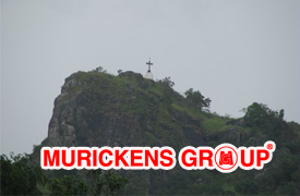
Located about 3 km from Vazhikkadavu in Kottayam, Kurisumala is this renowned Christian pilgrim centre where hundreds of devotees from far and near converge during the holy week and after, to climb the hill in faith, carrying small wooden crosses. The peaceful Monastry at the top of the hill, the silence of the hills, the cool mountain air and the lush green landscape are all soothing to the soul. On the eastern side of the hill is Muruganmala housing a rock cut temple dedicated to Murugan (son of Lord Shiva). The road to Kurisumala offers some real sightseeing opportunities in a European model house and the beautiful artificial lake, both designed by the renowned architect, Laurie Baker.
Located at a height of 1337 meters above sea level in the dense thickets, is the beautiful.This temple is built in the traditional Kerala style of architecture. his temple allows visitors only on the day of Chitra Pournami festival.
The ancient temple of Mangala Devi is hidden in the dense woods at the top of a peak 1337 m above sea level. The temple is built in the traditional Kerala style of architecture. Visitors are allowed here only on the Chithra Pournami festival day held during the month of April / May. The peak commands a panoramic view of the eastern slopes of the ghats and some hill villages of Tamil Nadu.
Deep inside the forest of Periyar Tiger Reserve, you will find a 1000 years old ancient temple of Mangaladevi. This is the place, where, Kannaki, a legendary Tamil woman, betrayed all her grudge and transformed herself to be a divine lady (Mangaladevi) showering blessings upon the people on earth.
Hidden in the dense forest of Periyar Tiger Reserve, between Kerala and Tamil Nadu, the Mangaladevi Temple at Thekkady is not just a place for pilgrimage tourism, but a place where you can find the wildness of the forest and the enchanting beauty of the nature. The temple is located 7 km away from Pazhiyankudi in Theni district and 15 km from Thekkady in Idukki district.
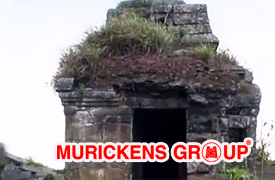 There is a mind boggling legend behind this divine temple of Mangaladevi. Kannagi, the devoted wife of Kovalan, took revenge against killing her innocent husband by accusing him as a thief. It is said that she burnt the whole Madurai city and later she reached the Suruli hills. From here she went to the heaven in Pushpaka Vimana along with Kovalan. Getting inspired from this story, Chera Chenguttuvan, the ancient Tamilakam King, erected this temple of Mangaladevi here. The story of Kannagi was narrated to the Tamil poet, Illango Adigal by Chenguttuvan and later Illango wrote the famous book 'Silappathikaram', the story of Kannagi and Kovalan.The temple is famous for its Pandyan architecture. The boundary walls and the steps leading to the temple are made up of huge stones. The location of the temple on the top of the hill itself proves the effort taken to complete the structure there. Apart from Mangala Devi you can also sight some other idols there. Entering the complex you can see the idol of Karuppuswamy, on the left side there is Lord Shiva and you can also sight a sanctorum for Ganapathy too. You can also find an underground passage from this temple. Numerous stories revolve around this passage. According to the local people, the passage leads to the Madurai town and some says that the passage will take you to the Pandya Kingdom.
Like the other temples in Kerala, Mangaladevi temple is not opened all the year round. The devotees can only worship the Devi during the time of Chitrapournami festival which falls on the month of April/May. This festival which occurs on a full moon day is jointly organized by the Kerala and Tamil Nadu governments. The priest from both the states comes to perform rituals during the festival. As the temple is in the edge of ruins, the panchaloham idol used for the festival is bought from Kambam.
Goddess Mangala is decorated with flowers, silks and poojas are performed. Thali (sacred thread used by married women) and bangles of women is kept for pooja here. This festival is very auspicious for women and the women folk offer pongala (cooked rice) to the Devi. Adequate measures are taken to avoid the disturbance to the eco system with the over crowding of the devotees.
To make a trip to Mangaladevi temple, you will have to get prior permission from the wildlife warden of Thekkady. The journey to the temple is an interesting and daring experience. You can reach the temple only with the help of a jeep. The 12 km long way to the temple is covered with dense forests and grasslands. You will also get a chance to experience the delightful sights of Nilgiri Tahr and other varieties of flora and fauna.
There is a mind boggling legend behind this divine temple of Mangaladevi. Kannagi, the devoted wife of Kovalan, took revenge against killing her innocent husband by accusing him as a thief. It is said that she burnt the whole Madurai city and later she reached the Suruli hills. From here she went to the heaven in Pushpaka Vimana along with Kovalan. Getting inspired from this story, Chera Chenguttuvan, the ancient Tamilakam King, erected this temple of Mangaladevi here. The story of Kannagi was narrated to the Tamil poet, Illango Adigal by Chenguttuvan and later Illango wrote the famous book 'Silappathikaram', the story of Kannagi and Kovalan.The temple is famous for its Pandyan architecture. The boundary walls and the steps leading to the temple are made up of huge stones. The location of the temple on the top of the hill itself proves the effort taken to complete the structure there. Apart from Mangala Devi you can also sight some other idols there. Entering the complex you can see the idol of Karuppuswamy, on the left side there is Lord Shiva and you can also sight a sanctorum for Ganapathy too. You can also find an underground passage from this temple. Numerous stories revolve around this passage. According to the local people, the passage leads to the Madurai town and some says that the passage will take you to the Pandya Kingdom.
Like the other temples in Kerala, Mangaladevi temple is not opened all the year round. The devotees can only worship the Devi during the time of Chitrapournami festival which falls on the month of April/May. This festival which occurs on a full moon day is jointly organized by the Kerala and Tamil Nadu governments. The priest from both the states comes to perform rituals during the festival. As the temple is in the edge of ruins, the panchaloham idol used for the festival is bought from Kambam.
Goddess Mangala is decorated with flowers, silks and poojas are performed. Thali (sacred thread used by married women) and bangles of women is kept for pooja here. This festival is very auspicious for women and the women folk offer pongala (cooked rice) to the Devi. Adequate measures are taken to avoid the disturbance to the eco system with the over crowding of the devotees.
To make a trip to Mangaladevi temple, you will have to get prior permission from the wildlife warden of Thekkady. The journey to the temple is an interesting and daring experience. You can reach the temple only with the help of a jeep. The 12 km long way to the temple is covered with dense forests and grasslands. You will also get a chance to experience the delightful sights of Nilgiri Tahr and other varieties of flora and fauna.
This popular picnic spot is nestled between Tamil Nadu and Chellarkovil. One can try their hand trekking and mountain climbing over here. The picturesque location also provides the perfect gateway for an a valid photographer.

Pandikuzhi is a picturesque spectrum of exotic flora, fauna and gurgling streams is cradled between Chellarkovil in Idukki and the Tamil Nadu border. A popular picnic spot, Pandikuzhi offers great opportunities for trekking and is a photographer's delight. Pandikuzhi is located about 5 km from Thekkady and about 4 km from Kumily.A popular picnic spot, Pandikuzhi is located 5 kms away from Thekkady between Chellarkovil and the Tamil Nadu border. Pandikuzhi is a picturesque hill station all endowed with lush greenery, natural waterfall and myriad of flora and fauna. This place offers great opportunity for trekking and getting clicked at the most delightful site featuring green sheet of foliage.Another enchanting destination for nature lovers is Pandikuzhi. They are heaven for those travellers, who love more to indulge with nature and want to be one with the greenish environment. Varieties of flora and fauna, the chilling streams are some of the specialities of Pandiluzhi, which is ideally placed between Chellarkovil and Tamil Nadu Border. If you are an adventure lover, or a person crazy with camera and photography, then don't delay your trip to Pandikuzhi. The deep valleys, the exotic flora and fauna, the unique heritage, the beautiful streams, the splashing waterfalls, villages and event the people around will make you stay here and to visit this place again and again. Pandikuzhi is located just 5 km away from Kumily. People nearby localities and those who are easily connected to this place, prefer it as a weekend destination others can choose this place while their trip to Thekkady. People, who are always busy with their daily chores, find this place as a getaway to relax and rejuvenate them. The nature itself involves in this healing process. Don't ever miss the cascading waterfalls of Pandikuzhi. The waterfall, splashing from 1200 feet height, is a sight, which you can never miss. Imagine the waters sprinkling upon you, the roaring sound of the water splashes and the cool climate around. Now, why wait to be at Pandikuzhi...Reaching Pandikuzhi is not a big job for you. It is easily accessible through bus, auto or simply by a trekking. You can board a bus from Kumily to Kattapana and just get down at Ettammile or Anakkara. You can also choose an auto rickshaw to Chellarkovil, which is around 1 km away from Pandikuzhi. Now an adventure lover can choose a trekking to Pandikuzhi, which is also advisable. Another choice is to board a bus from Thodupuzha to Kattapana and alight at Puliyanmalaor and then get into a Kumily bus and alight at Ettammile. Pandikuzhi welcomes you round the year. But the best time to be here will be from September to March. From morning till evening you can roam around this beautiful destination. Entry fees are not needed. You will be getting facilities like restaurants, hotels and resorts at Pandikuzhi.
Vacations. This lovely place offers a splendid view of diverse flora and fauna. The place is accessible only by a jeep. One can also see the famous Sri Ayyappa Temple and the Sabarimala hill from here.

Forty Six kilometres away from Thekkady and very near to the Periyar River lay a beautiful hill station, Pullumedu. Literally, 'Pullumedu' means green meadows and when you are here, you will definitely find, how ideal this name is. Yes, Pullumedu is a place filled with green meadows and it looks like a green carpet over the earth. You can never miss a destination like 'Pullumedu', when you are planning a trip to Thekkady. The destination lies 26 kilometers away from Periyar. Apart from its scenic beauty, Pullumedu is also known for its spiritual elements too as it is connected with the famous 'Makarajyothi celebrations' and academicians are also interested in Pullumedu. In the month of January, Pullumedu sees a huge rush of Sabarimala devotees, who gather here for witnessing the divine 'Makarajyothi' (celestial light) from here. It is a visual treat to view Sabarimala temple from Pullumedu and it is very easy to watch the divine jyothi (Makara jyothi) from Pullumedu. Devotees from around the world gather here to watch this celestial light, which they consider as most divine. 'Pullumedu' also makes us to remember the 2011 Pullumedu stampede that took the lives of several devotees. Don't hesitate to pray for them too. The tragedy happened during a 'Makarajyothi celebration' in 2011. The devotees, who gathered to watch the Makarajyothi became the victims. Around 106 devotees were killed in the tragedy and another confusing fact is that, the reason behind such a tragedy still remains unknown. Pullumedu is also blessed with rich varieties of flora and fauna. Visit here to find rare species of plants. Certain areas around Pullumedu are not opened to tourism. You cannot visit such places. These are maintained to balance the eco-system here. A minor disturbance can hurt the whole balance of the nature. So, be cautious about it. Months from September to December are considered to be the best time to be at Pullumedu. It will be difficult for you to have a trip to Pullumedu during rainy season. There are chances of getting drenched in the rain and lose the whole fun of the trip. The above mentioned months will be cool and also the hill will be filled with the green cover. Indulge with the beauty of this place and forget all the hurdles of your life. Pullumedu is easily accessible as it is connected through rail, road and air. Move through the Ernakulam-Thekkadt road to reach the destination. Kottayam is the nearest railway station and Cochin is the nearest airport. For visiting 'Pullumedu', it is necessary to have prior permission from the wildlife preservation officer, Thekkady or the range officer, Vallakadavu. Being at Pullumedu, you can also make a trip to the nearby destinations like Cheeyappara waterfall, Anjuruli waterfall and Idukki Dam at Idukki. Spent the most valuable time of your leisure trip at Pullumedu and take home these precious moments....
The place is marked by lush green hills and enchanting mist. This place offers a great view of nearby villages and the fresh mountain air works wonders for your health.

A hill station and hamlet in the Idukki district of Kerala, Ramakkalmedu is one of the most beautiful destinations in Kerala, which cannot be neglected while having a trip to the Gods Own Country. Ramakkalmedu is located in Karunapuram Panchayath, just 15 km east of Nedumkandam in Thekkady. Ramakkalmedu stands on the Western Ghats at an altitude around 3500 ft above the sea level. green hills and the fresh mountain air make Ramakkalmedu an enchanting retreat. The place gets its name from the impressions of the feet found on the rock surface here, which is believed to be of Rama, the incarnation of Lord Vishnu, as told in the Indian epic Ramayana.Located in Idukki district of Kerala, Ramakkalmedu is about 40 km from Thekkady, which is one of the popular wildlife destinations in Kerala. The captivating hills of Ramakkalmedu in the Western Ghats, which is about 16 km from Nedumkandam.Ramakkalmedu is noted for its hills and also for the panoramic and picturesque views of villages in the neighbouring state of Tamil Nadu, which is towards the eastern side of the Western Ghats. A noticeably tall, pillar-like rocky structure, about 300 m high and facing east is another attraction here.It is one of the windiest places in Asia and being so, one can also find here a wind farm generating electricity, which is an undertaking of the Government of Kerala.Other attractions in-and-around Ramakkalmedu include places like Frog Rock, Turtle Rock and the highest twin-statue in Kerala; called Kuravan and Kurathi.
Vandanmedu is famous for its extensive cardamom plantations and is the world's largest auction center for cardamom.
 One should take a walk through these lovely plantations to get that heady feeling.
Vandanmedu is a village in Idukki district in the Indian state of Kerala.Vandanmedu is the biggest cardamom plantation in India.Vandanmedu is a wonderful village located in the high mountain ranges of Western Ghats in Idukki district of Kerala. This place is famous for its large production of Cardamom in the world because of the good climate conditions and soil. Most of the area in this place is covered with green dense forest and rough mountains. It is said to be that British planters were the first one those who found out the opportunities for planting cardamom, coffee and pepper in this region.
This town is famous for its pepper, coffee and tea plantations. The mighty Periyar River flows right through the center of this town thus providing natural irrigation. Vandiperiyar is a major trade center and also has many factories. The place also has widespread nurseries of roses, orchids and other exotics flowering plants.

Vandiperiyar is a town in Idukki district, Kerala, India. It is known for tourism, tea and coffee plantations, black pepper and other spice products. A number of tea factories are situated in the town. The Periyar River flows through the city.Vandiperiyar is a beautiful small town located in the Idukki District of Kerala. It is a very famous tourist attraction featuring cultivation of different spices with ultimate view. The prominent river Periyar flows through this town, which further helps in providing water for irrigation and other domestic uses. During the visit, tourists can head to the Flower Garden and Government Agricultural Farm, where array of rose plants, orchids and anthuriums will offer you an eye pleasing sight. The production of tea, coffee and pepper over here leads to the source of income for large amount of people living in this village.Vandiperiyar is located 18 km from Thekkady in Idukki district. The River Periyar flowing through the centre of this town nourishes its vast tea, coffee and pepper plantations. A major trade centre, Vandiperiyar is also home to a number of tea factories. The Government Agriculture Farm and Flower Garden have a delightful array of rose plants, orchids and anthuriam.Vandiperiyar is on National Highway 183, directly connected with Kottayam. Thekkady is 18 km away.Tea, coffee and pepper plantations are abundant. They are the main source of income for many people.
Located just outside the Periyar sanctuary, Kumily is a famous plantation town. This lovely town has extensive plantations of various Indian spices. It is a famous border town of kerala and Tamilnadu and is also noted as spices market

Kumily is a beautiful town in Kerala nearby Thekkady and Periyar Tiger Reserve. It is a popular tourist destination and lies in the National Highway 183 that connects Kottayam through Mundakayam and Kanjirappally. This place offers an easy access for many Kerala bound merchants and laborers. The two revenue villages of Periyar and Kumily constitute Kumily panchayat, which lies at the junction between Kerala and Tamil Nadu.Earlier Kumily was known as Kuzhumoor, used to be the capital of Thekkumkoor Kings. In the 18th century Marthanda Varma of Travancore defeated the Thekkumkoor Rajas. After India's independence, Travancore merged with Cochin to form Travancore-Cochin which again, sometime later, joined with Malabar district of Madras state to form Kerala.When the Britishers came to the city they made extreme changes in term of cultivation and working conditions. They made forest land used for plantation of tea, coffee, ginger, cardamom and other spices. So like this people were bought to work in Kerala. In 1920's different stories were made when large number of Malayalis arrive to this place. According to them one of the Malayali settler bought land from certain Ankur Rawther, a shepherd who lived in this area in the 19th century. Rawther is supposed to help the king of Travancore and his followers find their way out of the forest when they got lost while hunting in the particular rural area. In reward for this the king gave him acres of forest land.
MURICKENS GROUP
HO : KOTTAYAM-KADUTHURUTHY
BR : KOTTAYAM- CEMENT JUNCTION
ERNAKULAM-PALARIVATTAM
Real estate cunsulting officials at U.S.A. (Texas & Newyork) & Bombay
Email : mg@murickens.com, murickans@gmail.com